
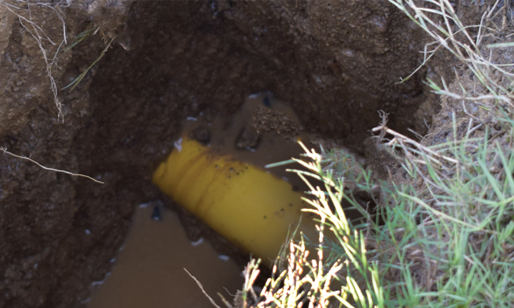
Abandoned lines have long been a topic of discussion and frustration in the underground utility industry, leading the Common Ground Alliance (CGA) to adopt Best Practice 4-11 more than 20 years ago. This best practice stated that “information on abandoned facilities is provided when possible… and that when located or exposed… should be treated as live facilities.”
Earlier this year, the Best Practice Committee revisited the language of 4-11 and made an important modification. The updated language states, “Information sharing can be done with field markings or by sharing the location digitally. When abandoned locations are shared digitally, it is for informational purposes only, the approximate locations of underground facilities are shared by the facility operators based on best information available.”
The inclusion of digital locating in industry standards and language is a milestone for the digital community because many states have adopted CGA Best Practices into their respective laws. Additionally, the Pipeline and Hazardous Materials Safety Administration (PHMSA) frequently references industry best practices, expanding the reach and influence of digital locating across the country because of this modification to Best Practice 4-11.
From a damage prevention culture perspective, digital locating is not simply a technology change; it is a shift in how information is trusted and shared. As Line-Scape has observed through its work helping utilities improve infrastructure records and mapping accuracy, confidence in digital locating grows in direct proportion to confidence in the records supporting it. Any successful digital locate program depends on an industry culture that values accurate records, continuous data improvement, and shared responsibility among operators, locators, and excavators. Simply stated, the more accurate your facility maps become, the faster you will trust a digital locate.
The effectiveness of a digital locate is ultimately determined by the quality of the underlying data. A digital process built on poor records can increase risk, while a digital process built on accurate mapping can significantly improve both efficiency and damage prevention outcomes. Much like the walk-back feature on locating devices proves where a mark was placed, it does not prove the mark was accurate.
As Mark Drew, President of Vivax-Metrotech, observed, “The future of digital locating depends on more than capturing a GPS coordinate. We are advancing electromagnetic locators into field verification tools that evaluate the physics behind the locate, including the signal response, consistency, depth, current, and distortion. By generating locate-condition indicators in real time, locators can provide supporting field evidence that helps users make more informed decisions from digital locate records.”
The same principle applies to digital locating. Technology can document and communicate information, but the quality of that information remains dependent upon the accuracy of the records behind it.
Digital locating is not new technology. In many respects, it is existing technology finding a new and higher calling. Similar technologies have been used for years by the U.S. military and the Army Corps of Engineers to locate and identify unexploded ordnance. While the terminology differs, the fundamental workflow is remarkably similar to underground utility damage prevention. Both industries are attempting to answer the same basic questions: “What is buried here? How confident are we in that information? What actions should be taken before excavation begins?”
Digital locates often generate a variety of reactions, but generally speaking, they refer to the use of digital mapping, GIS data, utility records, and electronic communication to identify and communicate the approximate location of underground facilities. In the case of abandoned utilities that may no longer have access points or visible indicators, digital locating may be the only practical solution for identifying their presence and location.
Consider a common scenario. An excavator submits a locate request, and the 811 center transmits the ticket to four utility operators within the proposed excavation area. Each operator responds and physically marks its facilities. Before beginning work, the excavator potholes and exposes four facilities within the tolerance zone. Seeing four exposed lines and expecting four utility owners, the excavator assumes the area is clear to proceed.
What the excavator does not know is that three of the exposed facilities are active and one is abandoned. A fourth active gas line remains unexposed because the excavator believed all expected facilities had already been identified. The abandoned facility unintentionally masked the presence of the active gas line. If information regarding the abandoned facility had been communicated digitally, the excavator would have known to continue searching for another active utility. The result could have been the prevention of a near miss, a utility strike, or a catastrophic event.
The concept of digital locating has evolved from what many viewed as a futuristic idea only a few years ago into a recognized CGA Best Practice. This evolution has occurred not only because of situations like the example above, but also because the industry has increasingly recognized the value of accurate mapping and data-driven decision-making.
Ultimately, the conversation about digital locating is not about replacing paint, flags, or traditional locating methods. It is about improving the quality and availability of information. Every improvement in utility records, every abandoned facility documented, and every map tied accurately to a land base increases the industry’s ability to make better decisions before excavation begins.
The modification to Best Practice 4-11 signals something larger than the acceptance of a new process. It reflects an industry that is beginning to recognize that protecting underground infrastructure depends as much on information management as it does on field operations. As damage prevention continues to evolve, organizations that invest in accurate records, digital mapping, and information sharing will not simply be adopting new technology—they will help build a culture where better information leads to better decisions, fewer damages, and safer outcomes for everyone involved.