
GPR Innovations Provide a Critical Layer of Damage Prevention Assurance for the Greatest Utility Infrastructure Overhaul in the Past Decade
5G’s arrival represents North America’s greatest utility infrastructure overhaul of the past decade. From Alaska to Florida, locators and contractors must prioritize preventing damage to existing infrastructure as new installations are implemented to accommodate the latest data revolution.
Rather than installing or reconfiguring large-scale cellular towers for 5G, many telecommunications providers are adopting a more innovative approach. Instead, these companies are partnering with contractors to deploy small cell towers in strategic locations. Once activated, these towers augment existing 4G LTE signals from larger towers and convert them to 5G. Think of it as like installing a home Wi-Fi booster to expand the router’s reach, but beyond extending a signal, these small towers also enhance it.
Before installing a small cellular tower, placing a One Call is mandatory prior to laying foundation or other infrastructure. However, having fulfilled the One Call obligation does not always mean it is safe to commence excavating. Rather than breaking ground and hoping for the best, why not utilize a solution that provides a more complete picture of the subsurface?
5G installations require a tangible and holistic damage prevention strategy. What does this solution look like, though? It should offer optimal performance across North America’s diverse field conditions, image the entire subsurface for both conductive and non-conductive materials and grant the user the ability to compile actionable data that can be stored or shared with other stakeholders for immediate impact.
One company is using an advanced ground penetrating radar (GPR) system to do just that. Small Cell Services designs, tests, installs, and maintains small cellular towers across the southeastern United States. After a One Call locator’s inaccurate marks led to damage incidents, the company purchased a premium GPR system for a more complete second opinion of subsurface conditions at installation sites.
Special Projects Manager, Brian Long, explained some ways that he uses GPR at the forefront of his damage prevention strategy.
THE FIRST STEP AFTER THE FIRST STEP
No matter the project, Brian and his team always call 811 before excavating as required by law with enough time prior to starting the project. Once the project begins, Brian surveys the site with GPR to verify the marks and check for private lines or other objects of interest that could pose damage risks.
GPR images the entire subsurface instead of looking for specific materials. With his system, Brian can view visual data in real-time to confirm marks, identify potential missed targets and observe field conditions like changes in soil structure. This data provides the confidence to commence digging and the insight to modify plans as needs arise.
Regardless, the result is the same — peace of mind knowing that exhaustive measures have been taken to identify and mitigate damage risks before breaking ground.
DETECTING THE UNDETECTED
Due to common factors like insufficient documentation, incomplete maps, or decommissioned facilities, utility lines can remain undetected for long periods of time. This problem intensifies when considering non-conductive lines like concrete and PVC that often have no tracer wire attached to them.
Because Small Cell Services’ towers require a 10-foot (~3.05m) deep foundation with a 2-foot (~0.61m) radius, any phantom utility lines near the installation site must be located, documented, and accounted for. Logistical challenges increase when factoring in other necessities like installing pull boxes, fiber and electric lines, and other infrastructure.
One could use a traditional electromagnetic or acoustic pipe locator for conductive and metallic lines. However, these cannot account for common obstacles like untraced PVC, concrete lines, or other obstructions. Here, locating becomes a guessing game for most.
Brian and his team implement cutting edge GPR technology to work around this. With a complete picture of the subsurface in hand, the team can ensure full and transparent views of field conditions, including the presence of nonconductive buried objects. The data collected results in a deliverable they can use to determine whether the installation site is secure, if it needs to move, or if any obstacles can be worked around or removed.
UNFORGIVING SOIL? NO PROBLEM
In more challenging soil types, traditional locating tools are less effective at delivering results. For example, a shallow-depth, high-frequency signal cannot penetrate through dense clay in New Orleans as deep as it can in Florida’s dry and sandy soil. Brian’s cutting edge GPR system uses a triple-frequency range antenna to help overcome difficult soil conditions and thrive in forgiving ones.
The antenna collects three separate datasets at low, middle, and high frequencies simultaneously. This allows for superior depth penetration at stunning high resolution without sacrificing middle frequencies considered the best for locating buried utilities. From there, he can review each dataset, together or individually, to cross-compare his findings for an accurate view of the prevailing field conditions.
UNIQUE CHALLENGES IN A CENTURIES-OLD CITY
With their headquarters just across Lake Pontchartrain from New Orleans, Small Cell Services often works in and around the Big Easy. The city celebrates a vibrant and rich history reflected by the infrastructure beneath its streets.
Brian shared some of the unique challenges when installing new infrastructure in a centuries-old city with historic neighborhoods like the French Quarter and Central Business District. These older, narrow streets often contain congested ROWs as well as plenty of private infrastructure likely undocumented for decades, if not centuries. In these places, finding the necessary 2-foot radius to install new underground fiber or electric lines can quickly become a hassle.
Contractors serving major cities with high foot traffic need to find space to install new infrastructure quickly, efficiently, and accurately without breaking ground to do so. Because GPR requires no digging to operate, Brian can glide the antenna over the roadway and collect necessary data without relying on more destructive solutions.
Thanks to his system’s durable design and its floating antenna configuration, Brian can go up and down curbs, over rough roadways and navigate less-forgiving rural environments without worrying about the system breaking down or losing signal. Here, he can uncover the city’s complex network of pipes and cables to identify available space without having to break ground until it’s time for an installation. This saves his team time and effort while enhancing the quality of their findings.

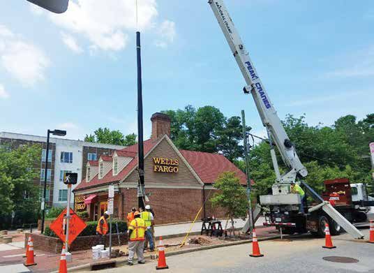
This Small Cell Services tower augments existing cellular coverage and converts it to 5G allowing for 5G coverage to reach more communities without a complete overhaul of legacy cellular infrastructure.
Like any product or service, GPR systems are defined by the benefits provided to the end-user. In this case, the data generated by a cutting-edge radar system provides a holistic view of the subsurface on the jobsite and provides a common point-of-reference for all present and future stakeholders involved on a project. No longer do installation and maintenance contractors have to survey the same site repeatedly, because now they have accurate documentation.
Once Brian and his team have finished an installation, they can re-survey the subsurface to create a new deliverable that reflects the updated infrastructure. From that point on, any future maintenance projects can refer to this data and understand the subsurface field conditions before placing a One Call. Using his GPR system’s advanced post-processing capabilities, Brian can also create GPS-integrated maps, 3D models, and detailed maps of his findings to add further context and perspective.
Ushering in the 5G data revolution also requires harnessing data beneath the surface. With the right GPR system, one can create a complete and more accurate picture of the subsurface to add a critical extra layer of damage prevention assurance for more streamlined installation of the new infrastructure throughout North America and the rest of the world. It’s time to prepare for the next great utility infrastructure overhaul the right way.
Ray Cummins is an engineer at US Radar Inc. He advises current and potential customers throughout the United States on GPR-driven solutions for their specific needs in the field. He can be reached at ray@usradar.com.